








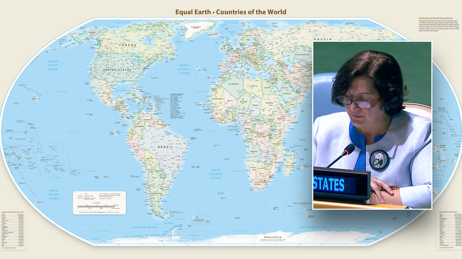
The United Nations overwhelmingly voted to adopt the Equal Earth map projection, a cartographic innovation that accurately depicts the relative sizes of continents, most notably showcasing Africa as significantly larger than it appears on the widely used Mercator projection. The resolution, introduced by Togo’s Foreign Minister Robert Dussey on behalf of the African Group, passed with 164 votes in favor, a near-unanimous endorsement that aims to foster a more equitable global perspective and understanding. However, the United States stood alone in its opposition, with Deputy U.S. Representative to the UN Economic and Social Council Yaryna Ferencevych labeling the seemingly innocuous map update as part of a “much larger and more radical ideological project,” criticizing the UN for debating “map projects from the 16th century” instead of focusing on “genuine problems of international peace, prosperity, or good relations.” The Equal Earth map corrects the distortions inherent in the 1569 Mercator projection, which, while historically vital for maritime navigation, dramatically enlarges landmasses near the poles and shrinks those near the equator, leading to a misrepresentation where Africa appears smaller than Greenland. While the resolution does not mandate the abandonment of the Mercator projection, which has seen a resurgence in digital applications like Google Maps due to its interactive capabilities, it signifies the UN’s official endorsement of equal-area maps as the preferred depiction of the world, a move intended to promote “projections that better preserve the true proportions of continents” and, as Dussey stated, “changes how we see the world,” paving the way for greater respect and peace among nations.
Adapted from: Latest World News on Fox News